
BREEZY & COOL WEEKEND
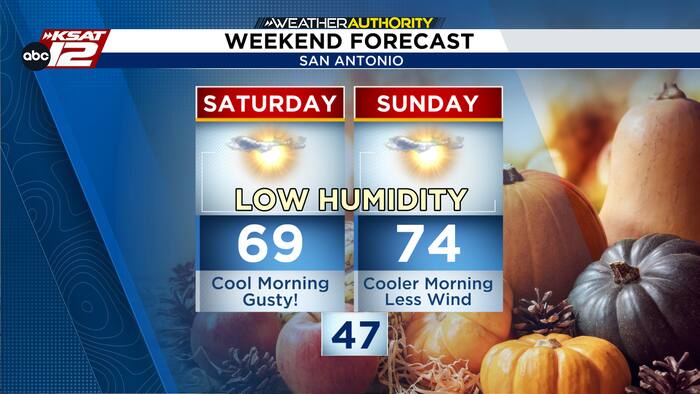
Saturday starts on a brisk and breezy note. Northerly winds will remain around 10 to 20 mph, with gusts of 25 to 35 mph possible through the morning. Winds will gradually ease during the afternoon.

Temperatures will be noticeably cooler, with morning lows in the 40s around San Antonio. Afternoon highs will only rebound into the upper 60s to near 70 degrees under mostly sunny to partly cloudy skies.
ANOTHER COOL START
With lighter winds and mostly clear conditions Saturday night, temperatures will tumble again by Sunday morning. San Antonio can expect mid to upper 40s, while parts of the Hill Country could fall into the upper 30s and lower 40s.

Sunday afternoon turns pleasantly mild, with lighter winds, plenty of sunshine and temperatures climbing into the 70s.
GRADUAL WARM UP
Temperatures will steadily climb next week with no rain in the forecast. Highs reach the 70s to near 80 by Monday, returning to the 80s by Thursday, while morning lows trend from the 40s and 50s into the 60s by Friday.


